Howth is beautiful little fishing village located approximately 15 km north-east of Dublin City. The Howth Cliff Walk is a easy to medium 7 km walk (Blue loop) or 6 km walk (Green loop) that takes you from the Howth Dart station along the beautiful Howth Harbour and up along the dramatic cliffs of the coastline of the Howth peninsula.
The views on this Howth Cliff walk are absolutely spectacular: you can observe Ireland’ s Eye around 1 km north of Howth Harbour, Lambay Island and also Dublin Bay. Lost of birds ( guillemots, razorbills, fulmars and gulls) can be seen along the walk so great for bird watchers.
Like the Bray to Greystone cliff walk, the Howth Cliff walk is the ideal Sunday family walk, easily accessible by public transport from Dublin. The Howth Cliff Walk is the perfect hike near Dublin!
There are 4 different way-marked cliff walk in Howth. So plenty of choice depending of your mood and the time you have.
Explore the full Howth Cliff Walk profile below for trail map, Driving or train directions, and more tips and details to help you enjoy this adventure right at the doorsteps of Dublin.
And don’t forget to leave your own review of this walk right at the end of this post!
Howth Cliff Walk Snapshot
| Hike Distance | 7 km |
| Difficulty | Easy |
| Duration | Approx 2 hours |
| Total Ascent | 194m |
| Trail Type | Lopp |
| Buggy | not buggy friendly |
| Dogs | Allowed in leash (watch the cliffs) |
| Hike Trail Map | Howth Cliff Walk Map |
| Dublin Drive | 30 min |
| Dubkin bus time | 55 min (bus 31 a |
| Dublin train time | 30 min |
| Driving Directions | Howth Driving Direction |
| Beauty | Wildlife, bird-watching, cliffs, Sea, photography, picnics, railway |
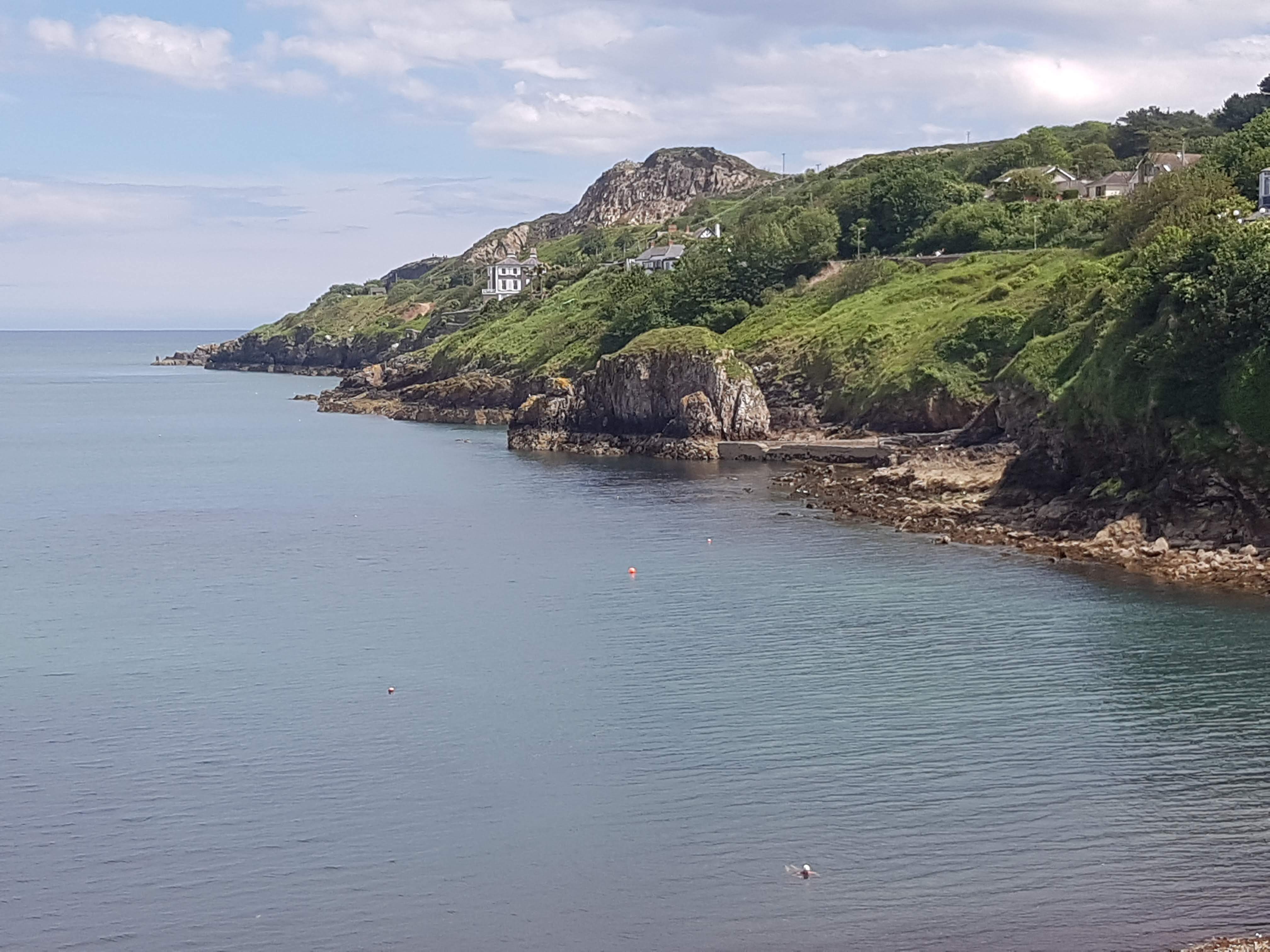
Howth Cliff Walk: Start of the Hike
Howth Cliff Walk: How to get there & trailhead
Like the Bray to Greystones Cliff Walk , it is easy to reach the trail head of this walk by using the public transport from Dublin.
By Train (DART)
This is probably the easiest way to get to Howth from Dublin city. You can get the DART (Dublin Area Rapid Transit system) Northbound from the train station of your choice in Dublin City (Connolly station, Tara Street, Pearse Street …) and be in Howth in approximately 30 min. Ticket fare for a return trip to Howth is around 6€. Check out the journey planner or the Irish rail website for more details. Make sure though that you get out of the DART at Howth station and NOT at Howth Junction which is a station before Howth.
Once you get out of the DART, you will find yourself right in the village off Howth, at the harbour and the start of the beautiful Howth promenade.
By road
If you decide to drive to Howth, just park you car at the car park at the Howth promenade, starting in front of Howth market, just after the railway station. Follow the Google Map Howth Driving direction.
By Bus
To go to Howth by bus, you need to take the number 31, 31a, 31b Bus from Talbot street or Abbey Street.For more information have a look at the Dublin Bus website. Its route, timetable and fare information make it easy for visitors to bus around the sights, and a real time information service shows when buses are due to arrive.
Howth Cliff Walk: the route details
Howth Cliff Walk Part 1: up to Kilrock car park
There are 4 different way-marked trails in Howth: green loop (Cliff Path Loop, 6 km) , blue loop (tramline loop walk, 7km), Red (black linn loop walk, 8 km)and purple (Bog of Frogs loop walk, 10 km). The one I am going to describe is the Blue loop\ Green loop. But all those trails have the same starting part of the Howth Cliff walk in common.
The Howth Cliff Walk starts at the DART (train) station in Howth village and follows the blue (and all the other color arrows!) arrows walking along Howth Harbour, the Marina all the way towards East Pier and the end of the promenade.
At the end of the promenade, turn right onto Balscadden Road. Notice the Martello tower on your right. It was build by the British in 1805 to protect themselves from a possible Napoleon Bonaparte invasion. Today, Howth’s Martello Tower is a vintage radio museum that exhibits radios and gramophones from the early 1900’s to present day.
Walk up the Balscadden Road and pass by the house, on the left side of the road, where lived the poet William Butler Yeasts between 1880 & 1883. You can often see kids jumping from the rocks below into the sea. After about 1 km, you will reach the Kilrock car park.
But just before that car park, you can enjoy a coffee or an ice cream in the little cafe on the left and enjoy the view from the its terrasse: observe this fantastic view , Ireland’ s Eye which is a bird sanctuary, and Lambay Island.
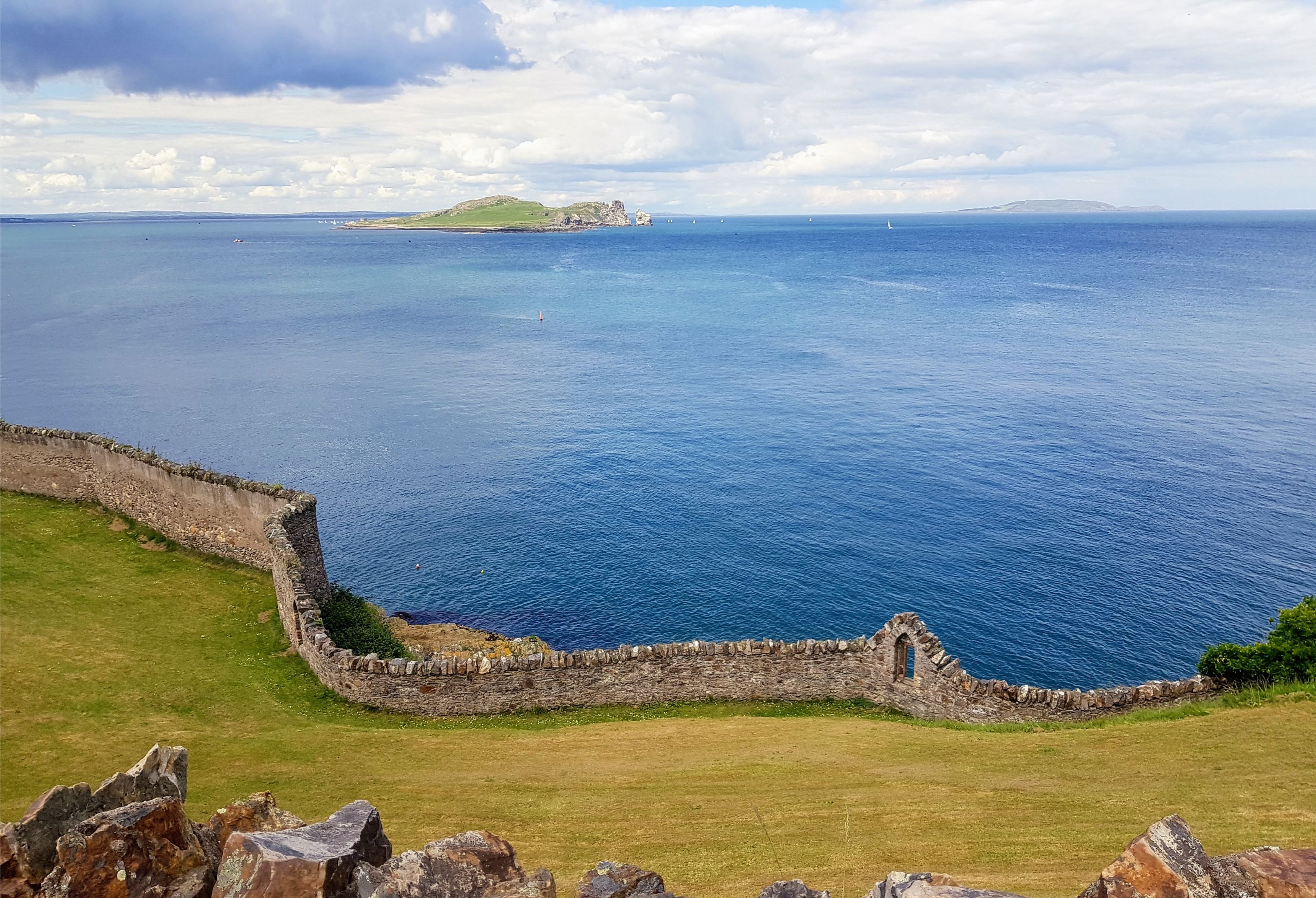
Howth Cliff Walk: Ireland’s Eye in foreground and Lambay Island in the background, with the Mourne Mountains in far background
Howth Cliff Walk Part 2: From Kilrock car park to The Summit Car Park
Once you pass the car park, you leave the tarmac road and start walking on a well trodden gravel cliff path for about 3 km. This is were you will appreciate the full beauty of the Howth Cliff Walk and understand why it is considered the best cliff walk in Ireland.
The cliffs are great to observe the birds nesting, guillemots, razorbills , fulmars and gulls. Grey seals may also be seen sometimes if you watch carefully. During the summer, the trail is lines by beautiful yellow gorse flowers, wild flowers and pink thrifts carpet the cliffs of Howth.
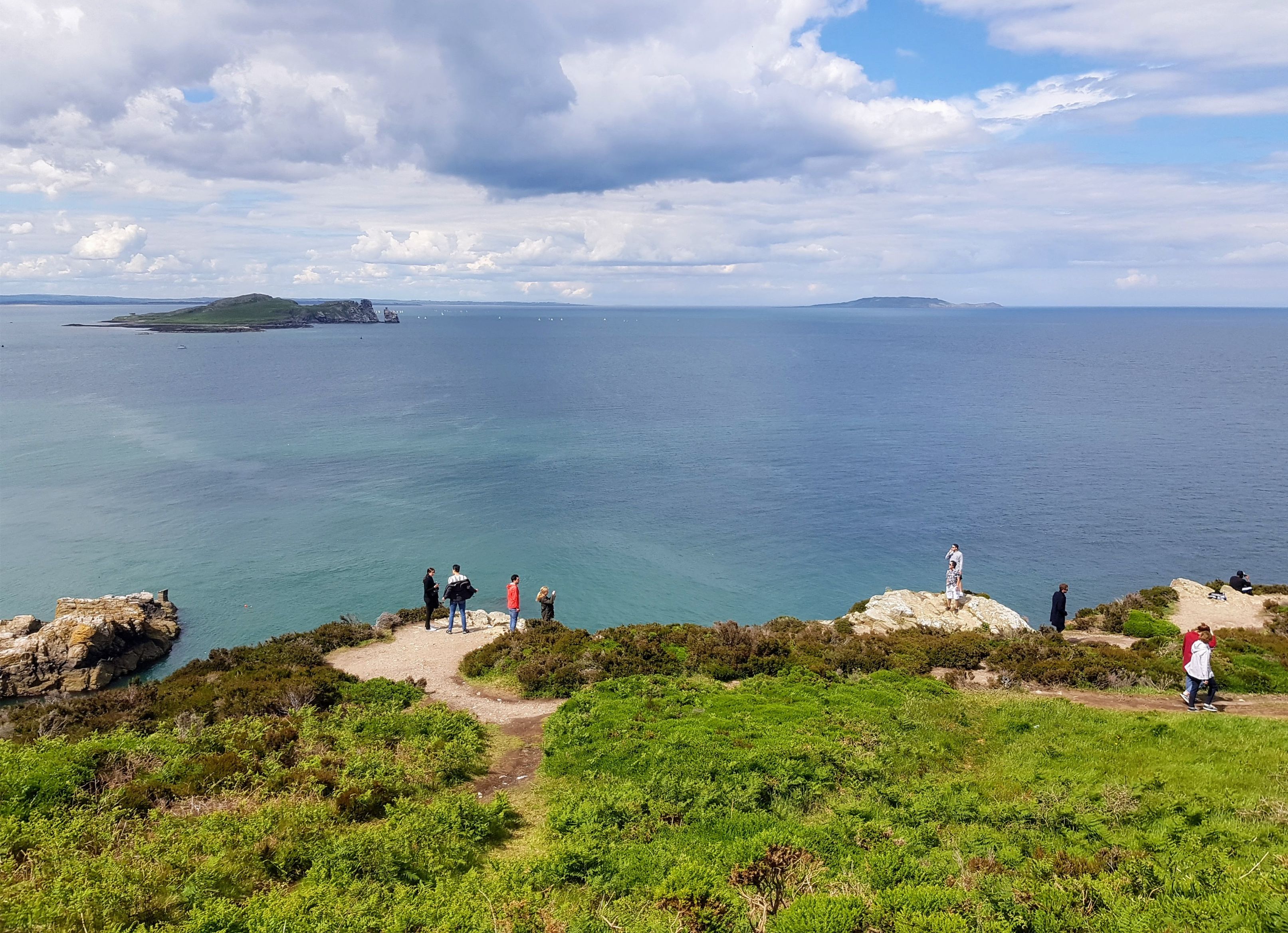
Howth Cliff Walk
Be aware that some sections of the Howth Cliff walk pass along the top of steep cliffs so I wouldn’t recommend to take this trail on very windy conditions.
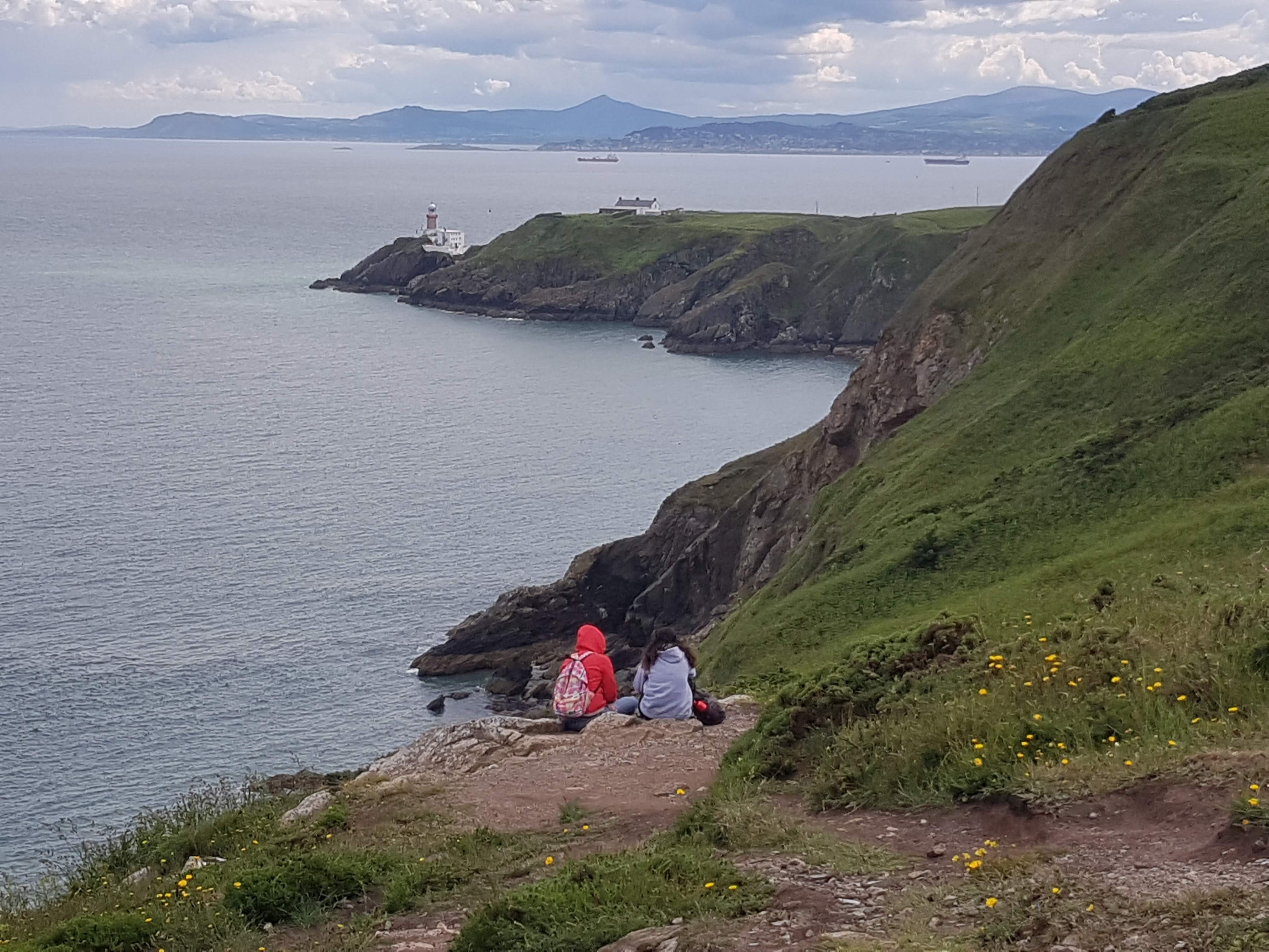
Soon you will see appearing the Baily Lighthouse and the end of a long promontory. And in behind it, you can see the coast of Wicklow. Built in 1814, the Baily Lighthouse is the last of Ireland’s lighthouses to become automated
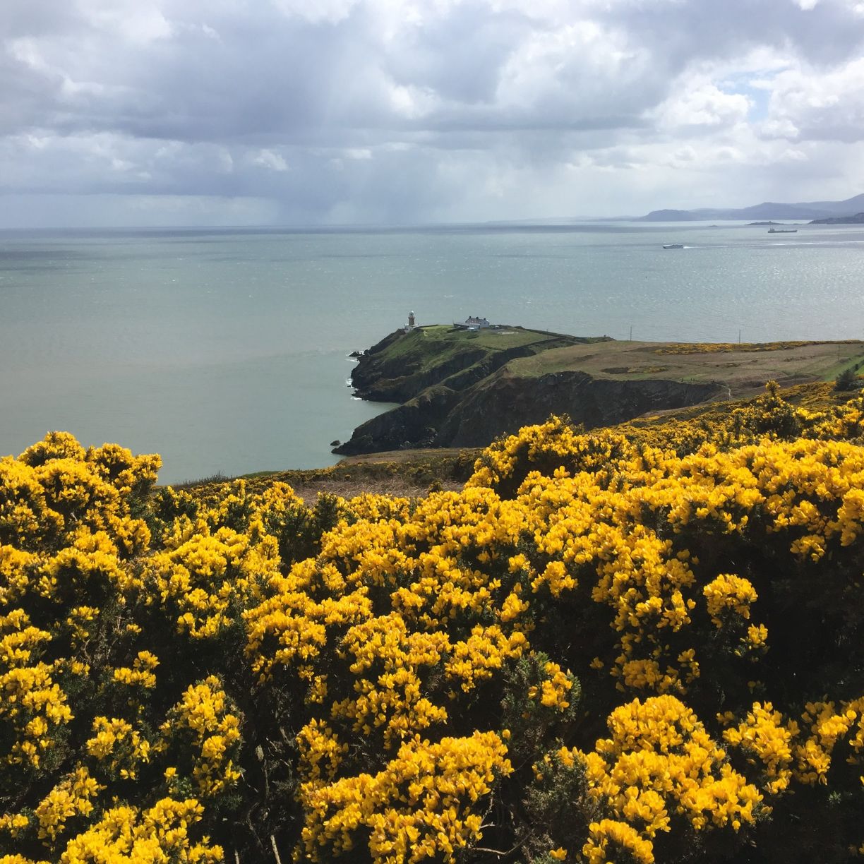
Baily Lighthouse & Gorse flowers
Howth Cliff Walk Part 3: From The Summit Car Park back to Howth Village
The trail will soon ascends uphill to the highest point at ‘The Summit’ car park. From here you return to Howth Village via the route of the old tramline (blue loop) going down the road until you reach a junction of roads at The Summit Stores and pub.
Just across the road from the Summit Pub, the entrance to the old tramline is marked by stone bollards. Cross Thormanby Road and join the tramline pathway. Follow the pathway downhill to exit directly opposite the DART Station
If you prefer to admire the sea view on the way back to Howth Village, just before you reach the summit car park turn turn right and begin the return journey along a sandy pathway parallel to and above the cliff path. At the end of the sandy pathway, the loop joins Thormanby Road where you turn left – almost immediately turn right onto Dungriffin Road.
After 200m along Dungriffin Road you will turn right and rejoin the blue and red loops on the tramline walkway to descend into the village directly opposite the railway station.
Once down in Howth village again, I would suggest you stop for the best fish and chips at Beshoff Howth on the main Harbour Road.
Did you Know?
Howth Harbour History
Howth Harbour was built in between 1807 and 1818 by an engineer called John Rennie. The granite stones used to build Howth Harbour came from the Dalkey carry. They were the same ones that were going to be used to build the Dún Laoghaire Harbour from 1817. The lighthouse at the end of the East Pier in Howth was built in 1817 and the adjacent lighthouse keeper’s house in 1821.
Howth Harbour was designed to receive the packet boats, or postal service ships, between Holyhead and Dublin. It was completed in 1809 and with this investment, including the construction of Howth Road to Dublin that was built to ensure rapid dispatch of incoming mail to Dublin, Howth started to take off. However, Howth’s period of importance was short lived.
By 1812, concerned were expressed already about the shallowness of the Harbour and the build up of sand that accumulated within the East Pier.
In 1818, the replacement of sailing packets with steam packets reduced the transit time from Holyhead to seven hours. Those steam packets were larger ships than the sailing packet and Howth harbour became increasingly unsuitable for this kind of ships.
Dún Laoghaire Harbour (renamed Kingstown Harbour at the time) construction started in 1817 and lasted until 1859 but by 1833 the packet service had already relocated to Dún Laoghaire. The smaller shallower harbour at Howth was forgotten about for twenty years thereafter.
Today Howth the biggest fishing port on the east coast, and Howth has become very popular spot for all foreign tourists visiting Ireland wanting a day out near Dublin.
King George IV visit:
One very funny anecdote about Howth Harbour is the visit of King George IV on the 12th of August 1821.The nobility and gentry of Dublin were all waiting for his arrival at Dun Laoghaire Harbour .Banners flew and bands played, and a crowd estimated at 200,000 awaited the British monarch. But instead of mooring in Dun Laoghaire in front of this huge crowd, King George IV moored in Howth. He disembarked his ship completely drunk, unattended by a single soldier and shake hands with several farmers and fishermen. The imprint of his footsteps were cut into the landing stone by a local stonemason at the time and can still be seen at the end of the West Pier
Read more about Howth Harbour
Route map for Howth Cliff Walk by romuald kieffer on plotaroute.com
Interesting links about about Howth:
https://www.irishtimes.com/opinion/sea-here-an-irishman-s-diary-on-howth-1.3536486
http://www.secret-ireland.com/howth-harbour-dublin/
https://afloat.ie/blogs/sailing-saturday-with-wm-nixon/item/31776-howth-harbour-thoughts-from-home
HAVE YOU DONE THIS HIKE? PLEASE LEAVE YOUR REVIEW DOWN BELOW
Submit your review | |
I do this hike regularly, several times every year. Always enjoy it as much each times. Views are absolutely amazing. Highly recommend it. Howth is easy access from Dublin by train so nice for those without a car. Nice description of the hike by the way on this website. Thanks

![Dalkey and Killiney Hill walk[Route details +Parking + all info 2025]](https://hikesneardublin.com/wp-content/uploads/2023/10/Killiney-Strand-and-beach-Bray-Head-in-the-distance-scaled.jpg)
