The Derrybwn and Spinc hike is a 13 km moderate loop hike that brings you to the south part of the Glendalough Valley, on the Derrybawn Ridge and via Mullacor to finish up on the Glendalough Spinc and back to the Glendalough car park.
This Derrybawn hike is a very good alternative to the traditional Spinc walk. It is ideal if you are looking to get away from the sometimes crowded paths around Glendalough. The views from the Derrybawn Ridge is one of the best in Ireland, really worth going there.
Explore the full Derrybawn Ridge & Glendalough Spinc Loop Hike profile below for trail map, Driving directions, and more tips and details to help you enjoy this adventure right at the doorsteps of Dublin.
And don’t forget to leave your own review of this walk right at the end of this post!
Derrybawn Ridge & Glendalough Spinc Loop Hike Snapshot
| Hike Distance | 13 km |
| Difficulty | Moderate |
| Duration | Approx 4.5 hours |
| Total Ascent | 625 m |
| Trail Type | Loop |
| Dogs | Allowed in leash |
| Hike Trail Map | Trail Map |
| Dublin Drive | 60 mn |
| Driving Directions | Driving Direction |
| Beauty | Lacs, River, Waterfall, Forest, Valley, Monastic site, Mountain, Panoramic view |
Derrybawn Ridge & Glendalough Spinc Loop Hike: How to get there & trail head
The start of the hike is in Glendalough located just about 1 hour drive from Dublin.
Many trails start in Glendalough and it makes it most certaintly the best place to go if you want a day out from the crowded street of Dublin and see one of the most amazing place near Dublin. The Glendalough Valley located in the Wicklow Mountain offers the most dramatics landscapes and beautiful scenery just on the doorstep from Dublin.
Glendalough by bus:
To get to Glendalough from Dublin, you can take the St. Kevins bus at 11.30 am from St Stephen Green North opposite Stephen Court(Starbucks). The bus journey is approximately 1h20. Then for the way back to Dublin, the bus leave Glendalough at 7.00 pm to arrive in Dublin at 8.45.The bus Return Fare is € 20.00 and the single Fare is € 13.00.
Check full routes detail and time table on http://www.glendaloughbus.com
Telephone: +353 (0)1 281 8119
Email: info@glendaloughbus.com
Glendalough by car:
The Derrybawn Ridge& Spinc walk can start from the free Lower Car park locate beside the visitor center and the amazing 6th Century Glendalough Medieval Monastic site .The obvious advantage is that this car park is free but also it allows you to visit and see the Glendalough Monastic site, its round tower and beautiful graveyard before heading for the trail head.
Alternatively, you can also park at the Glendalough Upper Car park ( €4 per car) just beside the Upper Lake and shave off 15 min of the walk. Just drive along the Lower Lake and you will see the car park on your left.
To get to to Glendalough from Dublin, take the M50 southbound then the M11 toward Wexford. You then merge onto the N11. Just after the Kilmacanoge petrol station, take the N11/R755 exit toward Dublin/Roundwood/Glendalough .
Stay on the R755 and keep following sign for Glendalough. The road starts to climb, first ascending between the Great and Little Sugar Loaf mountains,passing by Djouce Mountain (check out the Djouce walks). Next you pass by the lovely village of Roundwood, known to be the highest village in Ireland, and you continue through the winding road of the Annamoe valley, into Laragh village, to finally reach Glendalough Lower Car Park just before the Glendalough Hotel.
Derrybawn Ridge & Glendalough Spinc Loop Hike: Details of the Hike
Starting at the Upper Car park in Glendalough, head south West towards the Visitor center . The Visitor center (only open in the summer) looks like a little white cottage. Turn right and you will see the start of the Wicklow Way. Turn left and cross the bridge following the sign for the Wicklow Way and the Poulanass Waterfall.
Climb up beside the Lugduff brook, heading towards the Poulanass waterfall. At the junction, turn left over the bridge following the Wicklow Way. Follow the track for 700m and then follow it around sharply to the right.After another 500m or so, leave the Wicklow Way and try to find a path on the left through the heather that will lead you to the top of the Derrybawn Mountain.
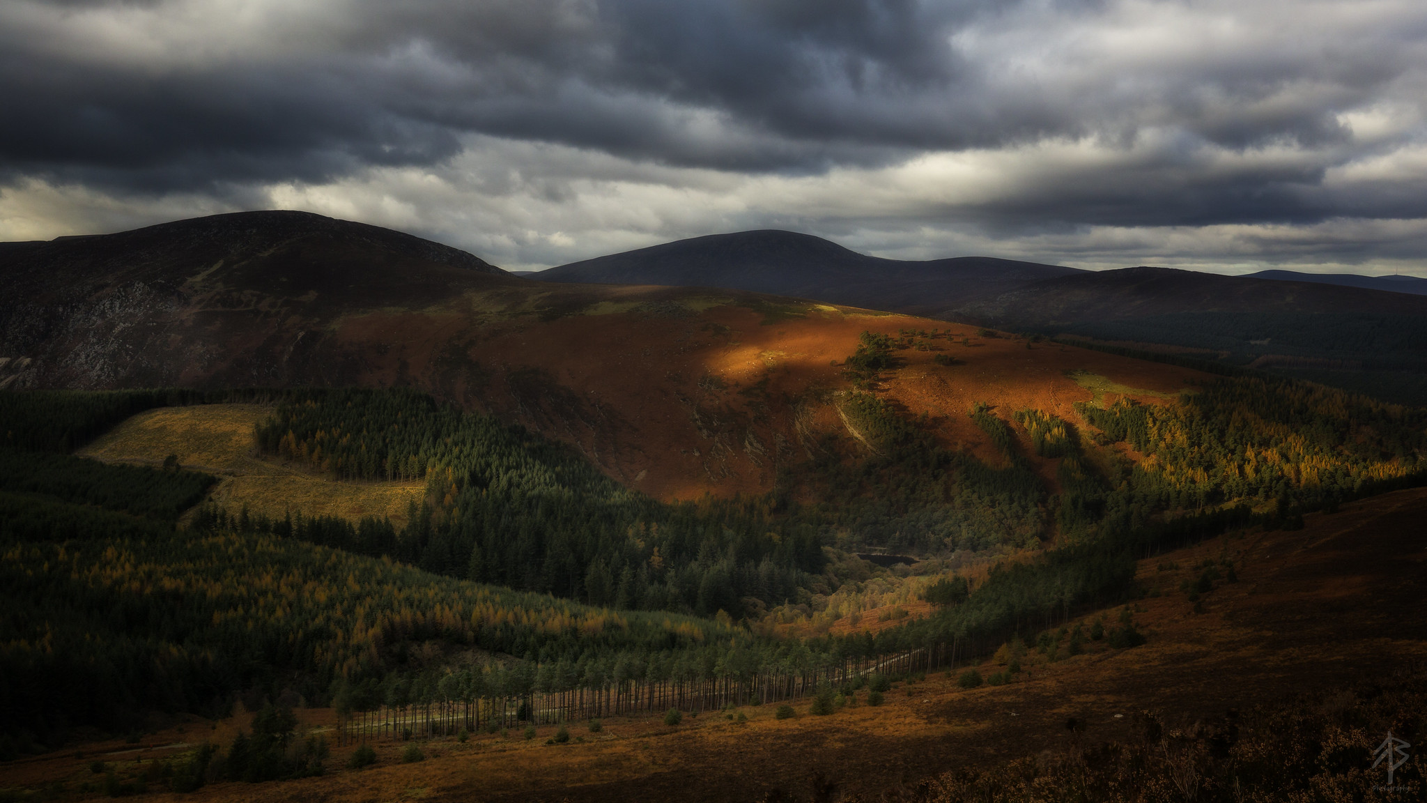
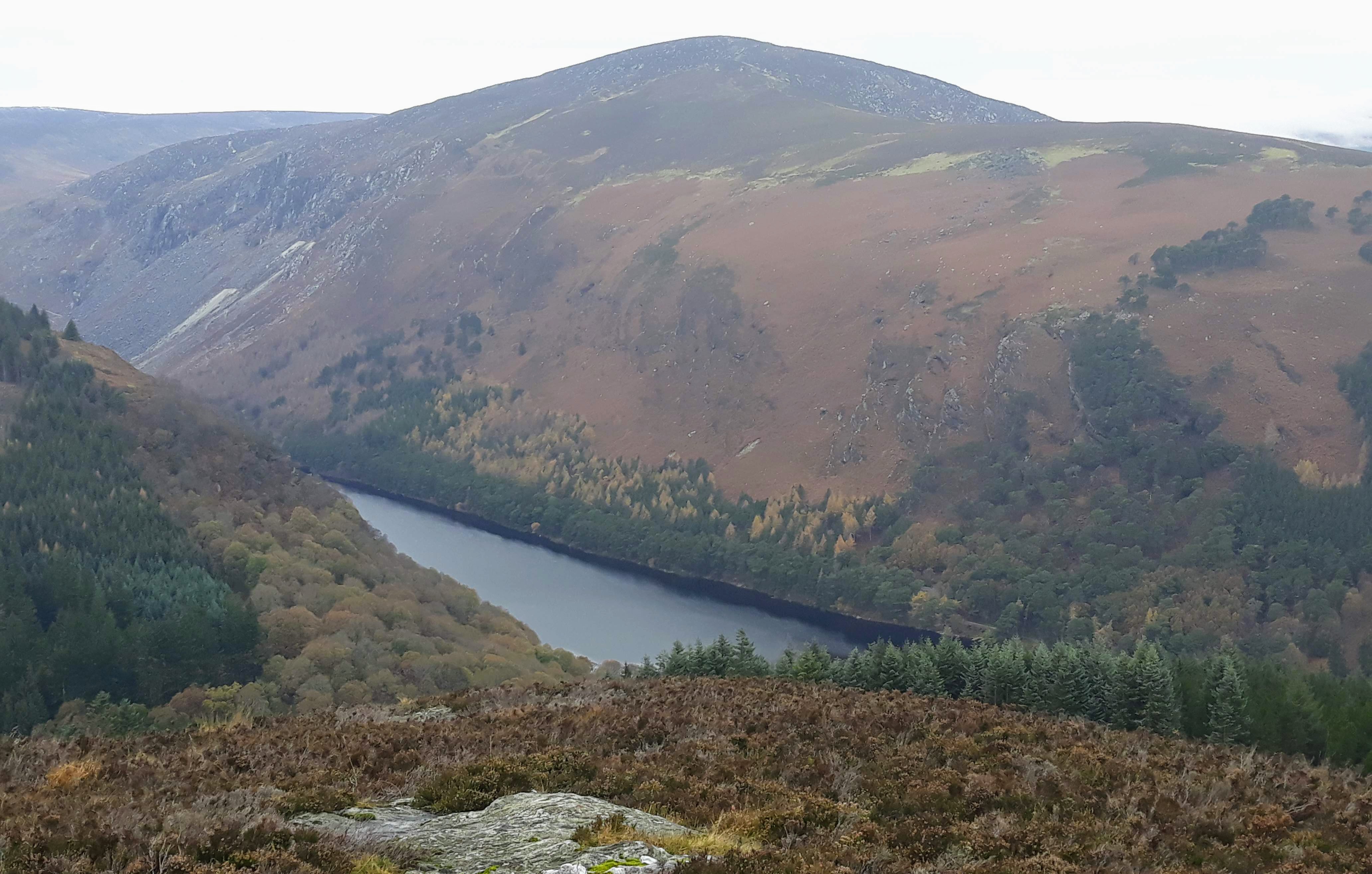
Photo courtesy of Feargal breathnach:View From Derrybawn
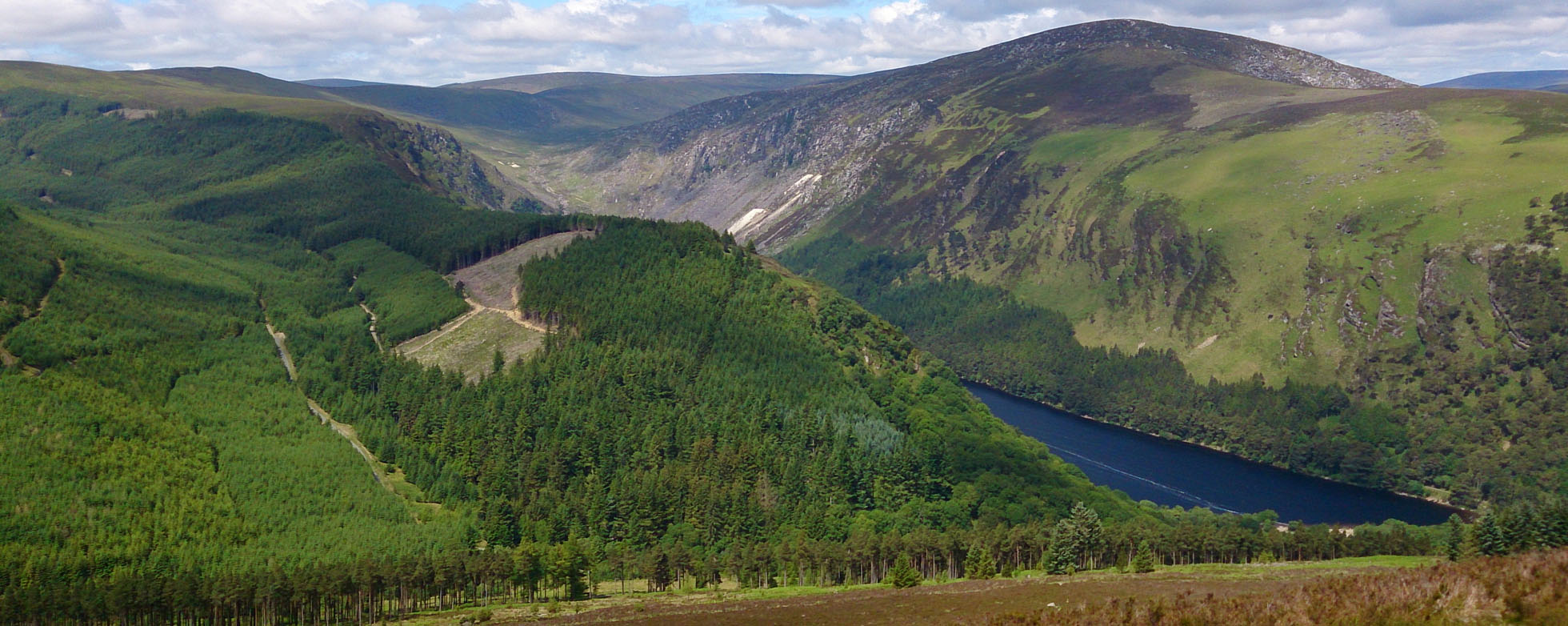
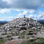
Once you reach the top marked by a small cairn, walk south west on the bumpy narrow Derrybawn Ridge. The views from there on the Glendalough Upper Lake are fantastic. On the Derrybawn ridge, the ground will varies from wet peat to rock underfoot. After approximately 1.9km follow a fence to the right and cross the stile.
Next make your way towards Mullacor. Head west for approximatly 1.6 km with the forest close-by on the right hand side. The ground there can be very boggy as you make your way to Mullacor summit so proper waterproof boots are a must. There is a small stone cairn at the top of Mullacor (657 m Summit). Again, the views up to Lugnaquilla Moutain are very impressive. In its foreground, across deep Glenmalure, is the most spectacular wild glen in Wicklow – the Fraughan Rock Glen with its tiered glacial coums, one atop the other, probably the site of the last mountain glacier in Ireland.
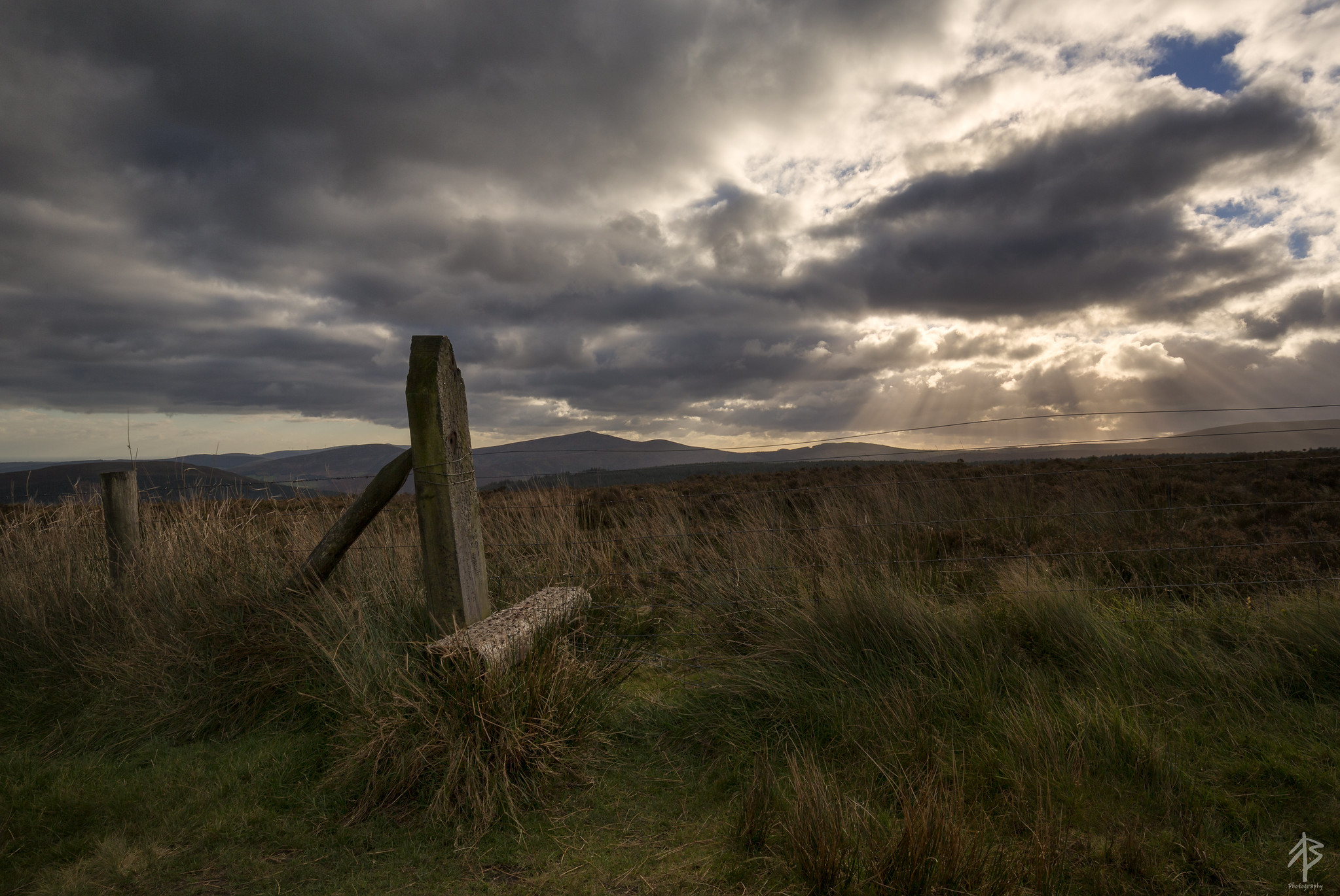
Photo of the stile taken by Feargal during on a small hike in Glendalough over Derrybawn, Mullacor & Lugduff
On your way down from Mullacor, you will eventually reach the boardwalk that crosses the pass from Glendalough to Glenmalure. Don’t follow the wicklow Way there but carry on north west towards Lugduff. After approximately 1km, you will see a track heading to the right skirting the forest in a clockwise direction. This track will link with the boardwalk along The Spinc and so back to the Upper Lake car park.
Route map for Derrybawn Ridge -The Spinc, Glendalough Loop by romuald kieffer on plotaroute.com


![Hell fire club walk in Dublin Mountains [Best View of Dublin City]](https://hikesneardublin.com/wp-content/uploads/thumbs_dir/IMG_7940-oa9z51rb5uqhy5lqtetov8rg50okxt2p8s8wavfal0.jpg)


